Feature

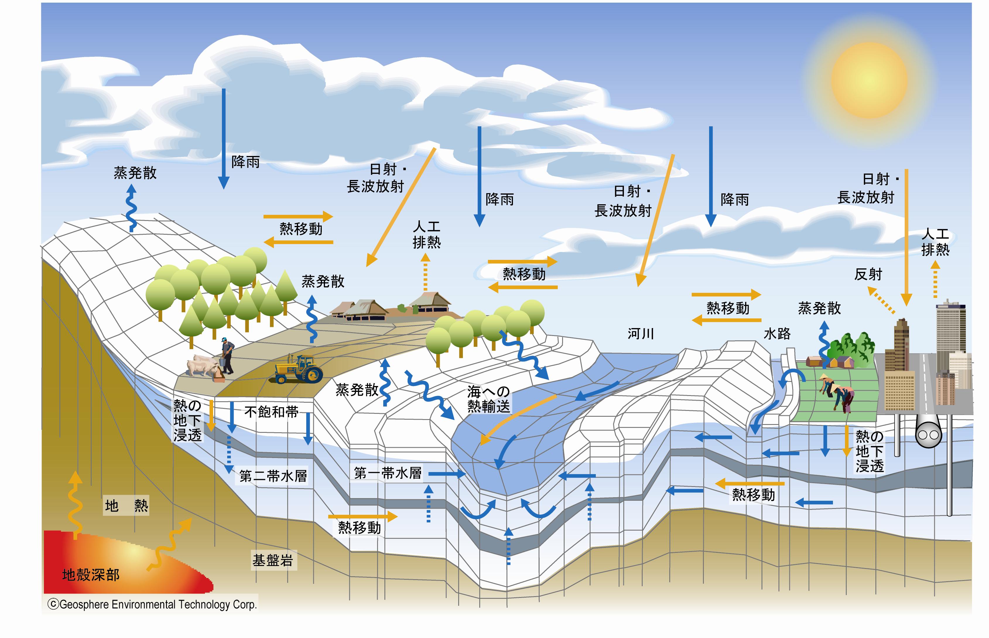
Conceptual diagram of the water cycle processes targeted by GETFLOWS
Conventionally, it has been used for a large number of terrestrial water circulation models that conceptually or physically combine river runoff analysis, flood analysis, groundwater analysis, which have been developed in Europe, the United States, and Japan, and are used by many researchers, engineers, and decision-makers.
GETFLOWS is one of the terrestrial water cycle models, but the main feature is that the mutual exchange of surface water and groundwater makes it possible to capture the target basin water cycle system more naturally. The applicability of GETFLOWS has been expanded to include multi-phase, multi-component, complete hydraulic coupling of surface water and groundwater, and transport of heat and sediment, which have been difficult to realize until now. GETFLOWS supports Parallel processing, and can simulate a very large-scale three-dimensional problem, for example, water circulation in an area of several thousand square kilometers or more can be analyzed transiently using order of millions of discrete grids. Also, it is possible to make highly reliable forecasts and evaluations.
The main fields of application are “water resource problems” such as water storage and drought prediction in dam construction planning and watershed resource evaluation, groundwater basin aquifer evaluation, flood/inundation prediction, slope collapse during heavy rainfall, tsunami intrusion, etc. “Water disaster problem”, “water environment problem” represented by soil and groundwater pollution by heavy metals and pesticides, and geological disposal of radioactive waste.
The features of the simulation system are as follows:
- A basin analysis that completely integrates both surface water and groundwater (surface flow of rainfall on the surface, seepage, groundwater discharge, river flow);
・Solution method by exact implicit difference method that exactly solves the conservation laws of fluid (mass conservation law, heat conservation law) - 3D corner point type difference grid for spatial representation flexibility, original high-speed solver (preconditioned conjugate residual method) achieves robust numerical stability, and sequential explicit processing speedup function
- Equipped with a region division function that individually solves regions (lattice groups) that change significantly and obtains the solution of the entire system while communicating in the sleeve region
- Practical use of large-capacity high-speed calculation on the scale of millions of grids by parallel calculation using PC clusters
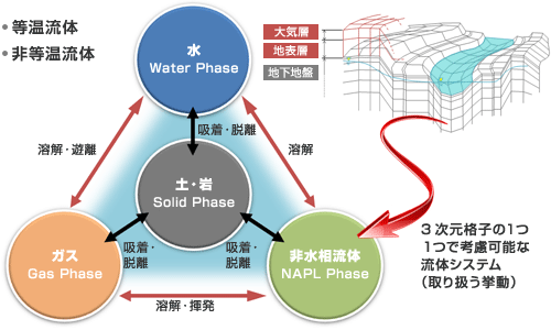
Representation of general fluid system in geosphere space
The target field is discretized with a hexahedral lattice. The fluid phase/fluid component (water, gas, non-aqueous phase fluid), and the state quantity of the solid phase of soil or rock (pressure, saturation rate, temperature, concentration, etc.) is calculated for each lattice. Analyze the dynamics of a general fluid system.

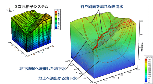
Analyze water flow seamlessly
 The rain that has fallen to the Earth surface infiltrates underground, flows in the ground, and part of the water flows out into the valley and becomes stream water that flows down. In places that cannot penetrate underground, it directly flows out as surface water. Analyze the natural continuous flow of water.
Initialization of natural state
Generally, the calculation start time of the basin model is near the start of observation, and the state of pressure and water saturation at this time is required in the simulation. However, since it is not possible for humans to specify all grid points, GETFLOWS uses the following method.
First, let’s imagine an initial state started long time ago. The easiest way is to assume that the ground is initially saturated with water and the surface is dry. By giving a certain amount of rainfall from here, and starts the calculation, the groundwater at a high altitude will flow to the surface of the earth forming river water, and the groundwater level will begin to drop. By continuing the calculation for a long time, the surface water and the groundwater will reach to equilibrium state and the basin will be in equilibrium.
Next, by continuing to give seasonally varying rains, seasonal changes in the basin will begin to appear. When the calculation continues with the daily change of precipitation, the state of the model is finally produced at the beginning of the observation.

How to create a natural state:
When the underground starts from the water-saturated/hydrostatic state in the early stage, groundwater at a high altitude starts to form and then the surface water starts to appear. Eventually, groundwater and surface water will settle down and reach to equilibrium state. Also, seasonal and daily fluctuations are given to create the condition at the start of observation.


